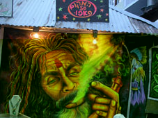
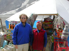
Shop catering to Israeli tourists
Once we reached Manali, the market for Malana's famous produce was quite apparent in the form of hordes of young Israelis, many of them either in a haze of pot or roaring up and down Old Manali Road on their Royal Enfield motorcycles. These just-out-of-the-army Israelis dominate the foreign tourist population in the region, and have a very mixed reputation with the locals.
Shop catering to Israeli tourists
Meanwhile, down the hill in New Manali, the streets are crushingly full of a very different species of tourist: the Middle-Class Indian Family. With the crowds, traffic noise, pollution, hawkers, and ugly buildings that completely obscure the mountains, you can feel like you've never left Bombay at all!
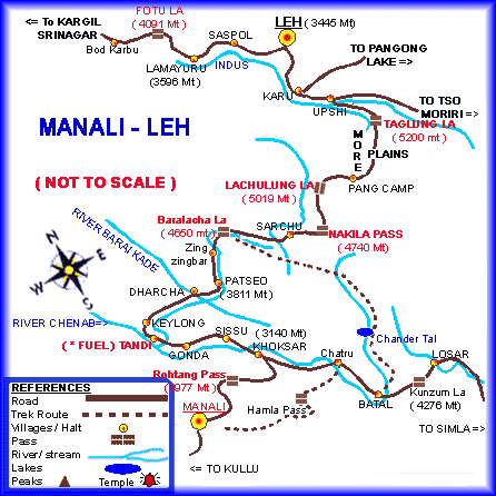
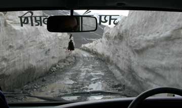
After a day in Manali, we were joined by our friends Jayashree and Minette, who had just arrived after an exhausting overland trip from Bombay. The next day we stocked up on Bollywood soundtrack tapes for the road (Lagaan, Don, Qayamat, Dil Chhatha Hai, Mohabathein, and two tapes of Asha Bhosle classics), piled into a Toyota Qualis and left on our great adventure, possibly the world's most beautiful road trip (and certainly one of the world's highest): the Manali - Leh highway. But we were not finished with the crowds just yet: the first 3 hours of the drive (during which Minette touched snow for the first time!) were bumper-to-bumper traffic with day-trippers from Manali visiting the 4000m Rohtang Pass. The Pass itself (which afforded beautiful views southwards) was basically a huge traffic jam-cum-parking lot.
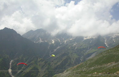
Paragliders off the Rohtang Pass
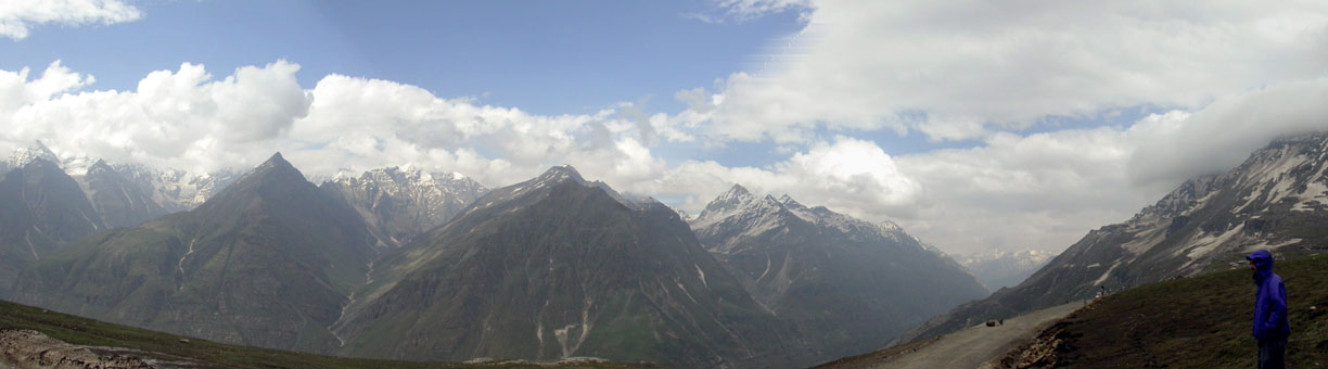
Matt looking out from the Pass (scroll right to see the whole thing)
Surprisingly, just a couple hundred meters past the official pass, where we got very different views north, the crowds vanished and the road became nearly deserted. Nearly but not quite: cargo trucks supplying Leh with everything from petrol to live chickens, and long convoys of Army vehicles, were our constant companions along the route. While they did not detract from the scenery, they did add quite a bit to the atmosphere--namely, great clouds of black choking fumes--and reminded us that despite appearances we were by no means in a wilderness. Sadly, pollution controls on trucks (which have done so much to improve the quality of life in cities like Bombay and Delhi) have yet to make their way to these remote regions. For entertainment, besides our own charming company and priceless singalongs to the soundtracks we played over and over, we had the constant company of road signs by Himank, "The world's highest construction company" and "The Mountain Tamers", who exhorted us to drive slowly: "Rather be Mr. Late than late Mr!", "Drive on horse power, not rum power!", and countless other gems.
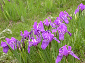
Irises
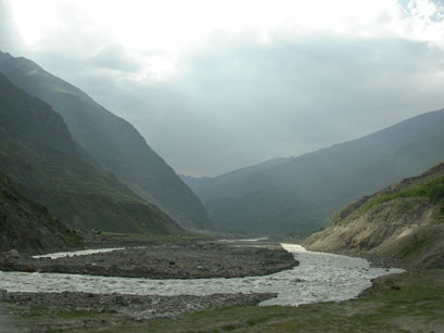
Chandra River
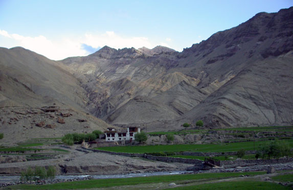
North of the Rohtang Pass lies the district of Lahul, bordering on Ladakh and as far north as the monsoon reaches before it is held back by the mountains. Lahul is therefore a transitional zone between the green mountains of Himachal and the desert of Ladakh. The people are also somewhere between Himachali and Ladakhi, in appearance and even in religion, following a syncretism between Hinduism and Buddhism. (In language as well; for example the Ladakhi word "la", meaning "pass", is common.)
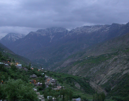
Keylong at dusk
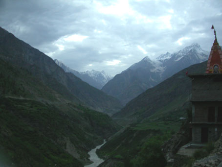
From Keylong
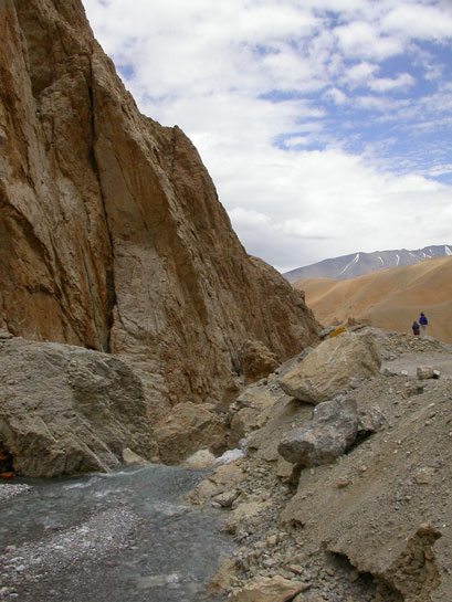
We spent the night in Keylong, the beautiful little town that is the capital of the district of Lahul. To avoid danger in crossing the glacial streams, which rise during the course of each day, we had to get started at 4 a.m. the next morning. So it was a short night--and not very restful, thanks to our overly enthusiastic fellow guests in the hotel. Our first stop was at a river crossing at Dharcha, where we had to wait for the guards to wake and brush their teeth so they could write the details of Matt and David's passports for no apparent reason.
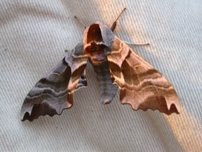
Moth on a tent at Dharcha, 4:30 am
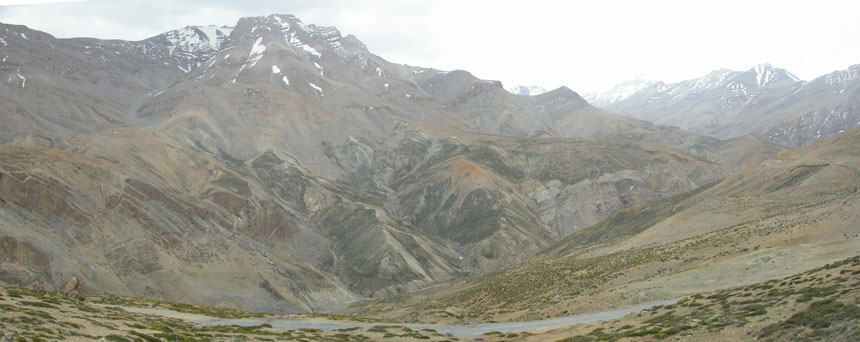
Our first order of business was ascending the Baralacha La (4650 m), which turned out to be the most "traditionally" beautiful mountain pass on our route - lots of snow and distant glaciers, fairly comprehensibly colored rocks. On the way down ino a gorgeous glacier-formed valley, we stopped for an excellent dal breakfast in Bharatpur, where the lady was deeply disappointed that David did not seem to remember her from his visit there last year (?!).
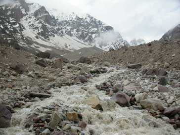
Crossing a stream
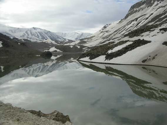
A pond at Baralacha La
David with his Bharatpur girlfriend
Coming down from Baralacha La
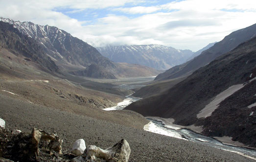
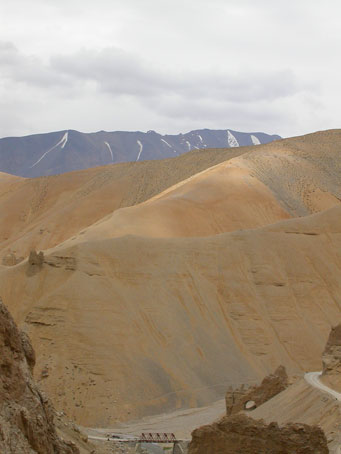
After the descent from Baralacha La, the scenery dried up considerably, leading to hills with strange sand formations. At Sarchu we crossed a canyon of the Tsarap river into the state of Jammu & Kashmir, humming the obligatory Led Zeppelin as we passed another obligatory passport check.
At Sarchu, the border between Himachal Pradesh and Jammu & Kashmir
Tsarap River
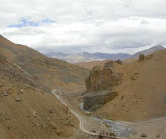
Our next pass was the Nakli La, famous for its succession of 21 Gata Loops, sharp switchbacks on the road which our car had to "negotiate" with trucks grunting and heaving their way up the steep ascent. The pass afforded some exciting views, and Minette's first snowfall.
The road winding its way towards the Nakli La
From the Nakli La
Coming close on the heels of the Nakli La was the Lachulung La, at 5019 m, where the effects of the altitude were already quite noticeable. The snow around the pass was contorted and serrated, forming surreal fields of snowteeth.
Towards Lachalung La
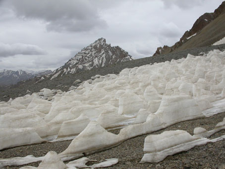
Odd snow formations, with long parallel toothed ridges, on the Lachalung La
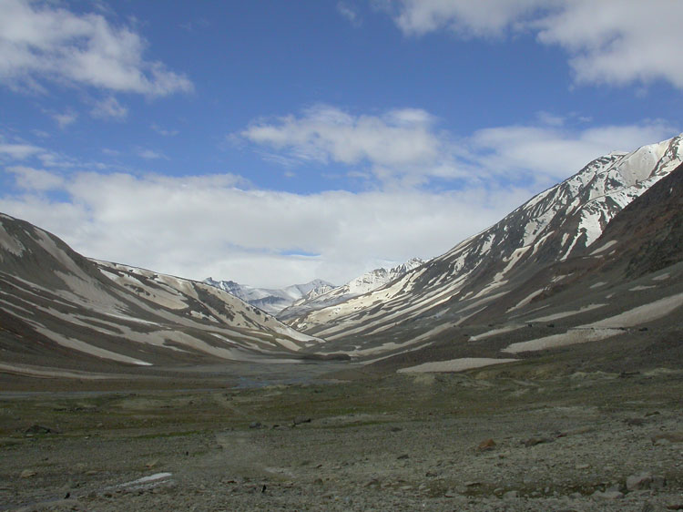
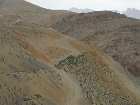
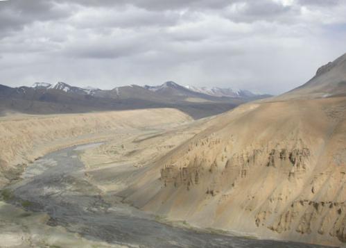
Coming down from Lachulung La, we really felt the desert begin, and the official introduction to Ladakh. This came quite suddenly. There we were, coming down a river bed, in fact in a river bed (the "road" at some point had ropes at its sides, which provided scant comfort given the rushing waters underneath), when we turned a corner and our breath was taken away: our stream tumbled down a waterfall into an unbelievable landscape of sand hills and snowcapped mountains. This is the postcard/t-shirt-perfect Ladakh, and we were blown away!
Just before Pang, there was suddenly a traffic jam: with the bridge under repair, the trucks had to cross a stream the hard way, and sometimes failed. (To add to the excitement, a couple of us had just read Vikram Seth's wonderful travelogue From Heaven Lake, where he nearly gets stranded in the Takla Makan desert due to a similar situation.) Luckily, with Sesram's steady hand at the wheel, we made it across easily, and then took a much needed break in Pang to have lunch and catch our breath break (hmm--we needed a break? what about Sesram, who had been driving since 4a.m.?!).
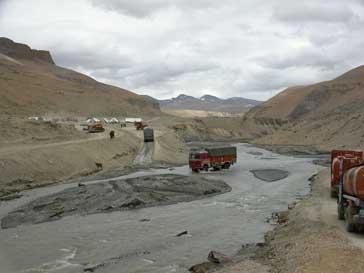
Trucks fording the stream
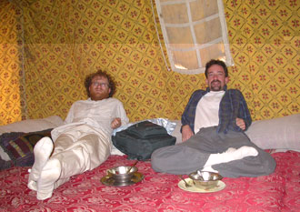
Lunch in the tent camp at Pang
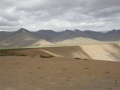
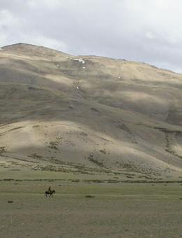
After another random passport check, the scenery countered by taking it up a notch, as we rose out of the sandy Pang valley, and without any warning found ourselves in scenery that (we imagine) resembles the steppes of Central Asia! The Morey Plains, which provided an unprecedented two hours of ruler-straight (albeit very bumpy) road, are home to nomadic tribes of yak herders. (As it turns out our trekking guide in Ladakh, Phuntsog, spends much of his time as a teacher with the nomads.)
The road rises up from the Pang Valley onto the Morey Plains...
...and suddenly one is in Central Asia
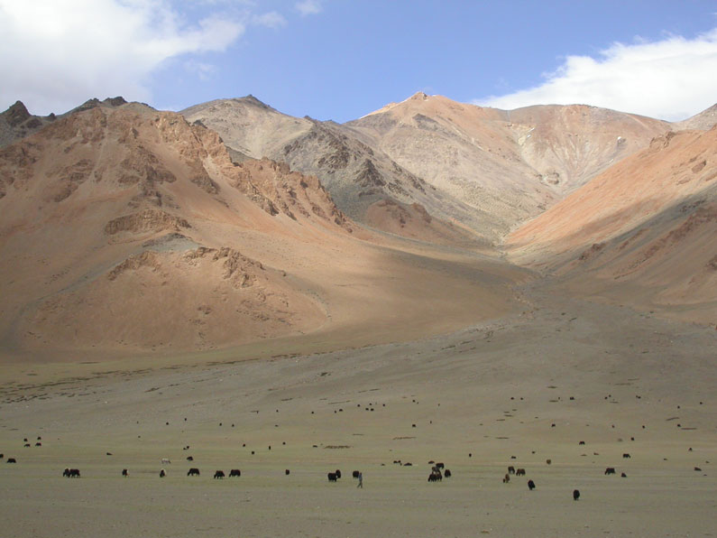
A herd of yaks
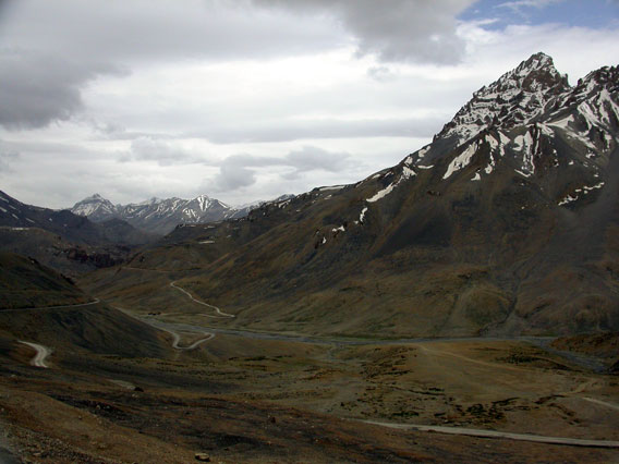
From the Morey Plains, the road wound its way slowly higher and higher through unbelievably desolate scenery, as our heads started to pound more and more from lack of oxygen. We ascended our final and highest pass, the Taglang La, the second-highest motorable pass in the world apparently, at 5370 m (the highest being the Khardung La, on the way north from Leh to the Nubra Valley--trust us, Taglang La is high enough). At the top we ran around giddily, amazed we had made it and not quite sure where or who we were (in the background Amitabh Bachchan was singing "Mai Hoon Kaun?" ("Who am I?") on the Don soundtrack in the car). We tried to take in the remarkable surroundings (and ubiquitous Himank signs) as fast as possible, and descend to the oxygen-rich comfort of, say, 3500 m above sea level.
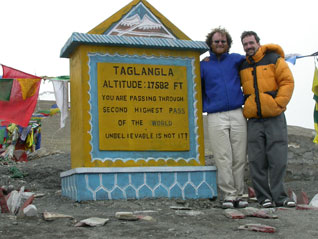
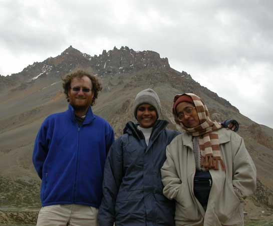
David and Matt on the Taglang La, the second-highest motorable pass in
the world at 5370 m
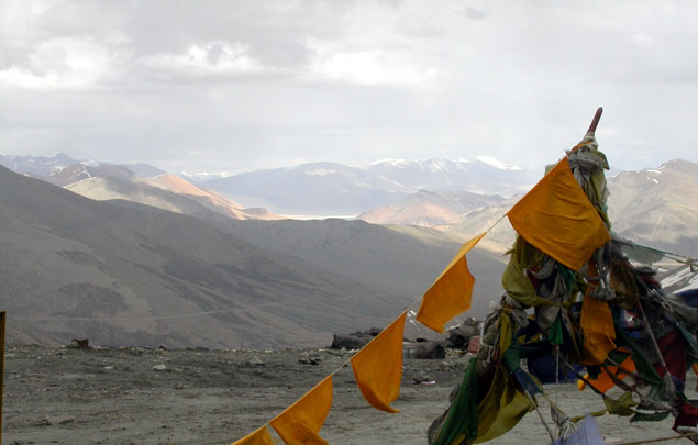
From the Taglang La
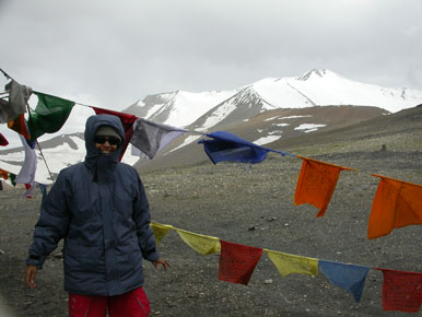
Minette on the Taglang La
By the time we entered the ruggedly intense, multi-colored, chorten-covered valleys of Ladakh on the other side of the Taglang La, we were praying for the scenery to stop being so stunning, or at least to maintain a particular style of stunning, since we couldn't really take much more in! We tumbled rapidly down a highly serrated canyon, home to the "World's highest iddly-dosa spot", according to our ever-entertaining Himank signwriters.
The road descends from the Taglang La into a typical Ladakhi
valley
After 7, we emerged from the canyon into open skies, a beautiful sunset, and another passport check: we had finally arrived at the Indus River. Though graceful and quiet here in Ladakh, this was the famous river that had cradled the first civilization of South Asia, and then gave its name, not only to lands through which it flows (Sind, in Pakistan, for example), but to so many lands and peoples to its east and south (that is, on the "other side" of it, from the point of view of Europe): Hindu, India, Indo-China, Indonesia, even, in a bizarre chain of events, some that are very, very far east indeed...West Indies, American Indian....
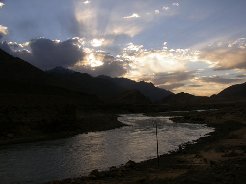
The Indus River at sunset
The last couple of hours into Leh was luckily a stretch of road we knew we'd return to, so we let ourselves stop having to take it in. We reached Leh after 9, completely exhausted (again, we have no idea how Sesram managed this driving feat, while remaining in complete and comforting control) and collapsed in our soft and overpriced beds at the Lotus Hotel.
Extra photos from the Manali-Leh Highway
Back to main page
On to part IV